Strata
Strata (singular: 'stratum') are geological surfaces used for charge design with G-Blast Charge Standards.
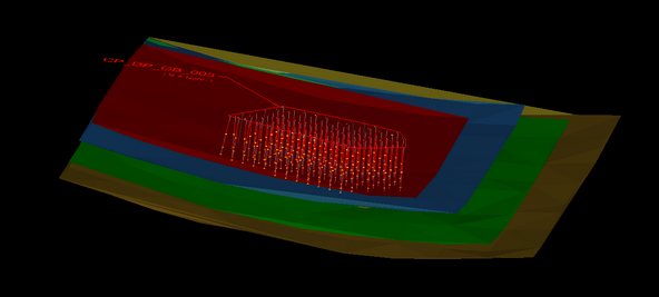
Geological strata in DataBlast Pro are viewed as triangulated surfaces; however, they are stored as point clouds. This enables the relevant sections of the strata to be loaded as required.
A stratum only displays if there is a design object within a certain distance, approximately 100m. Only the parts of the stratum in the immediate vicinity of the design load. You do not need to divide large surfaces into sections to create a usable model.
Each stratum consists of four fixed surfaces:
- Resource Roof
- Resource Floor
- Accurate Roof
- Accurate Floor

The geological resource model is used to define the resource roof and floor.
The accurate roof and floor is defined by intercept surveys, wireline surveys and drill logs. Using a point cloud with measurements of known accuracy enables a surface to be created that can be reliably used by the design engineer to define charging. G-Blast charge standards use the accurate roof and floor.

