
Rotate Map
To access this command:
-
Activate the Georeference ribbon and select Rotate.
Note: Georeferencing isn't relevant to level or wireframe maps, which always have a world coordinate context.
Both georeferenced and non-georeferenced maps can be rotated in any of the 3 major axes.
Typically, this function would be used to fine-tune the position of a map in the 3D world view following initial georeferencing.
The point around which rotation will, by default, be:
- The center of the current face (if no georeferencing has been applied)
- The point used to georeference the map (one point method)
- The first point used to georeference the map (two point method)
You can adjust the point around which rotation is performed using the Center of Rotation command.
You can reset georeferencing to the default settings using the Reset command.
Note: Current Azimuth, Dip and Roll values are displayed in the Map Properties panel, and updated automatically, during map rotation.
Selecting the Rotate function displays a map controller tool on screen, like this:
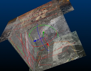
Once displayed, adjust the pitch, yaw or roll of the map (all associated faces) interactively by clicking and dragging either the blue, green or red aspect of the controller tool, for example:
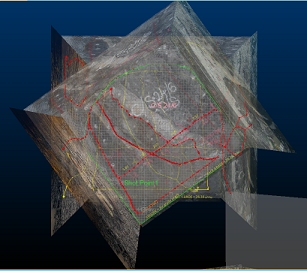
Map rotation updates the coordinates (world or local) of all map components.
The controller displays until switched off (using the ribbon button).
Note: Georeferencing refinement actions, including moving the center of rotation, can be undone and redone (CTRL-Z and CTRL-Y, or use the Undo and Redo buttons shown on any of the map draw ribbons).
Related topics and activities