
Coordinate System Selector
The Coordinate System Selector will only be displayed if you are importing some external map/samples in a project in which the coordinate system is not a local coordinate system.
Choose one of the two options:
-
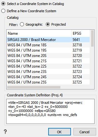
Select the Select a Coordinate System in Catalog option when the coordinate system is internationally known. The coordinate system should be listed in the Isatis.neo catalog or in the spatial reference catalog. Coordinate systems most used appear in this scrolling list.
- Then select the correct name with the EPSG code and IGNF code. When you select a coordinate system, you can observe the Proj4 code.
- Click OK to validate your choice.
-
Select the Define a New Coordinate System option, if the coordinate system is not in the scrolling list. You can then write the EPSG code, the IGNF code or the Proj.4 code. Once you have written the correct code corresponding an echo is displayed in the bottom box.
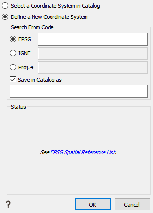
If you frequently use this new code, click Save in Catalog and enter a name.
- A link to all the EPSG codes on the official site of Spatial Reference is also provided. In this site, you can find other codes like the Proj4 code for example.
- Click OK to validate your choice and to go back to the Coordinate System Selector.
- Click OK to select the coordinate system.