Point Import
The point import is designed to load files that only contain a list of 3D points.
The input point file need to have at least three fields for the X, Y and Z coordinates. The allowed field names for X, Y and Z are:
- X / Y / Z
- XPT / YPT / ZPT
- XC / YC / ZC
All the other variables are imported as numerical or text variables.
Parameters:
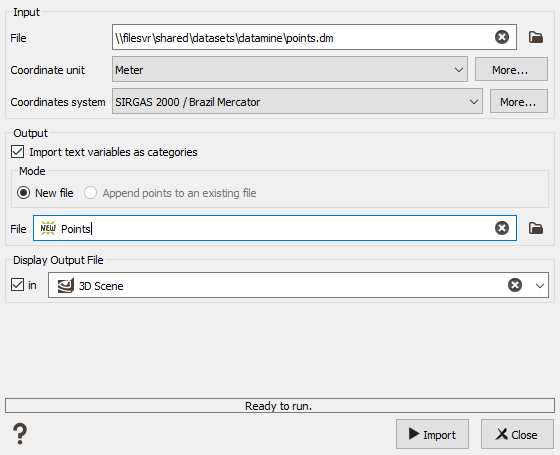
- Input File: select a Datamine file to import.
- Coordinate Unit: set the unit of the coordinates (longitude, latitude and elevation). The same unit will be applied to all the coordinates in the file.
- Coordinates system: select the coordinate system for the points file. This field is only available when the project is already defined with a specified system (not the Local User system).
- Import text variables as categories: check this parameter to create a categorical variable in the Facets data table for each string variable from the Datamine triangles file. An associated catalog is created at the same time, based on the variable’s name.
-
Output Mode: "New file" mode will create a new file on the Data Tree (or overwrite if you enter a name that already exists) whereas "Append" mode will add the points to an existing file in your Isatis.neo project.
In "Append Points to an Existing File" Mode, the new points are added at the end of the existing file, even if some points are already located at the same coordinates. The original variables that are not defined in the new point file will have an undefined value for the new points. Respectively, the variables only defined on the new point file will be set as undefined for the previous points.
- Output File: Name the file to create in the Isatis.neo project.
- Display In: Option to directly display the output file in a selected scene after the import. The points will be colored based on the values of the first numerical variable.


