Elevation Property
When representing a 2D file (points, grid, polygons or polylines) in the 3D Viewer, you need to define an additional Elevation parameter.
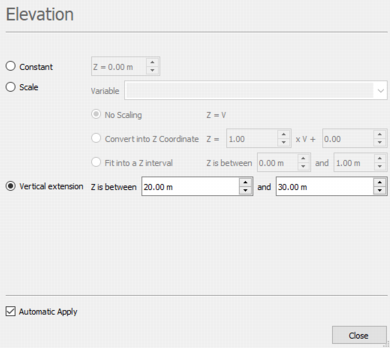
- Select Constant if you want all the points/grid cells/polygons/polylines to be displayed on a given level Z. Enter a value for this level.
-
Select Scale if you want to represent each point/grid cell/polygon/polyline at a level Z which will be read from a variable. Select the Variable of your choice in the next list.
- Select No Scaling to use the selected variable as it is. This is the default option when the selected variable is of Elevation unit class.
- Select Convert into Z Coordinate to calculate the elevation Z from the selected variable as: Z = A*V+B. Enter the values for A and B in the corresponding boxes.
- Select Fit into a Z interval to transform the selected variable so that the sample elevation lies between a given minimum value and a given maximum value.
- The Vertical extension mode is only available for 2D polylines. Select it if you want to represent the polyline as vertical walls which lie between a given minimum elevation and a given maximum elevation.