Local Anisotropies
Objectives
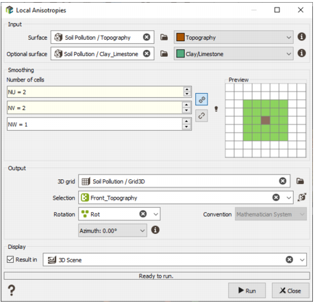
In geostatistical applications, estimations (e.g. kriging) rely on variogram models that may include anisotropies. These anisotropies are often defined globally, but in some geological contexts it is preferable to define spatially varying anisotropy directions.
The goal of the Local Anisotropies module is to generate such local anisotropies under the assumption that anisotropy orientations are guided by geological surfaces. Two cases are supported:
- Single reference surface: Anisotropy orientations are parallel to a reference surface.
- Two reference surfaces (typically a top and a bottom): Anisotropy orientations transition smoothly from being parallel to the top surface to being parallel to the bottom surface across the domain.
. On the right: the anisotropies are proportional between the two surfaces (in red).")
The resulting orientations are stored in a dedicated Rotation compound variable, which can be used by the Kriging and Simulations modules.