|
|
Giving maps a world context |

Georeferencing
Initially, maps are located using local coordinates; they have no geospatial context.
Typically, these 'local' maps are used as a canvas for digitizing features and other map items with respect to a captured face image. Studio Mapper presents each map using a map window.
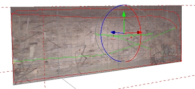
Georeferencing involves orienting a map in 3D world coordinates. Studio Mapper offers multiple methods for georeferencing. When a map is georeferenced, it will appear in the 3D World window, potentially as part of a collection of other georeferenced maps.
More about Map and World windows...
|
|
|
Georeferencing Tools Overview
Studio Mapper supports the following georeferencing methods and tools, available using the Georeference ribbon:
- One Point: orient your map vertically in 3D space by aligning two specified points (one on the map, one in the 3D world). The map azimuth will be set to zero, but can be adjusted afterwards. More...
- Two Points: orient your map vertically by aligning two points on the map with two in the 3D world. More...
- Rotate: rotate the currently active map around its origin using the Rotate tool. This lets you fine-tune the position of the map in 3D space. More...
- Center of Rotation: adjust the point around which a map is adjusted. More...
- Reset: reset the currently selected map to a local coordinate system and display a Map window. If data was previously displayed in the 3D world window, it will be removed from this view. More...
|
|
|
|
|
Related Topics |
|
|
Map and World Windows1 Point Geolocation2 Point GeolocationRefining the Map LocationCenter of Rotation |
Copyright © Datamine Corporate Limited
JMN 20045_00_EN