
Define Center of Rotation
To access this command:
-
Activate the Georeference ribbon and select Center of Rotation.
Note: Georeferencing isn't relevant to level or wireframe maps, which always have a world coordinate context.
Both georeferenced and non-georeferenced maps can be rotated around an origin. This can be useful to fine tune a map's azimuth, dip or roll.
The Center of Rotation command is used to change the origin position, which can be at any point in 3D space (either on or off a map face). Snapping is supported, which may be useful if you want to rotate around a specific drive landmark or shot point represented by point or string reference data. You can also snap to points or string vertices on map data, including comments data.
The rotation center point can be adjusted in either the 3D world view or a map view, and if both views are relevant (because the map is georeferenced), the point is synchronized between the views.
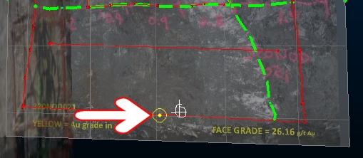
Activating this command highlights the current rotation center position in the current view (3D world or map view). For example:
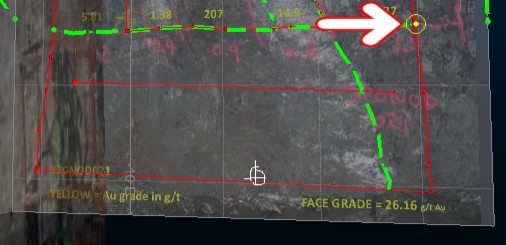
You can then left or right-click (to snap) a position in the current view. In the example below, the rotation center is snapped to the far left of a contact feature:
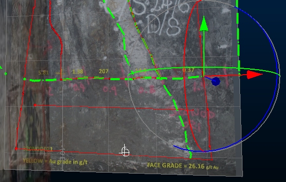
You can also left or right-click and drag the rotation point to
dynamically reposition it in relation to the current section or snapping
points, Releasing the mouse button or lifting the finger or stylus from
the screen will set the new position.
Subsequent use of the Rotate command will then rotate around the new
origin, for example:
Click Done to complete the command.
Note: Georeferencing refinement actions, including moving the center of rotation, can be undone and redone (CTRL-Z and CTRL-Y, or use the Undo and Redo buttons shown on any of the map draw ribbons).
Related topics and activities