
Customize backup
The Customize backup action is reachable when making a backup of a project from the Project Manager. The backup can be used to transfer data from one account to another, or from one system to another or to temporarily save disk space. As a backup can be space consuming or just to avoid sharing useless information, you can choose which objects you want to include in your backup.
All the objects contained in the project database are grouped by type through dedicated explorers: Data, Geostatistical sets, Chart files, Scenes, Neighborhoods, External files, Public folder content.
Note: The report content (contained in the report folder), the batch files (contained in the batch folder), and the installed Python packages (contained in the python folder) can be included or excluded in their entirety. You cannot select individual files from these folders (except when they are stored in the public folder), as they do not have dedicated explorers to customize their content in the backup.
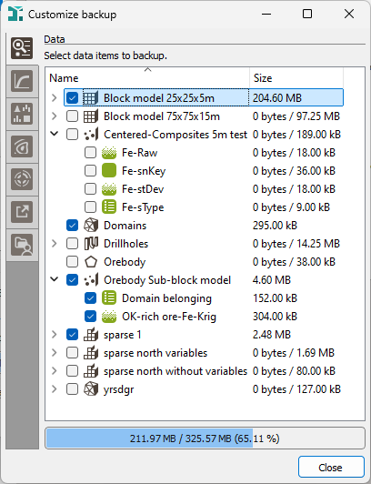
For each explorer, each object offers a toggle to indicate if you want or not to consider it in the backup. The corresponding size (on disk) is displayed to see which objects take up a lot of space. At the bottom of the explorer, the global size of all the selected objects is indicated. Click on column header to order objects by file name or by size (or also by path for the external files). As the Data tree organization is kept, we order by folder/file/data table (keeping folders always at the top) then by variables inside each data table.
-
Data: Structural variables are not listed here as they are compulsory for the backup. You can deselect all variables contained in a data table to only store its geometry (it can be useful for grids for example).
Macro variables can be particularly heavy to store (macro selection variables to a lesser extent). Consequently, it can save a lot of disk space to not store them in the backup (if you have a batch file to regenerate them or useful parameters are still loaded in the task if your reopen it). However, a macro variable is included globally in the backup, i.e. you cannot select only few indices to keep. This is the same thing for rotation/gradient compound variables.
The Resources Workflow Data (for the Mining edition) and the complete Kartotrak data tree appear in the Data tab, as well as all the associated objects (geostatistical sets and neighborhoods), if the project contains such data. They are all greyed out but unticking the Backup application items option will remove all of them from the backup at once.
For more information about the different types of data and variables, please refer to the Data chapter.
-
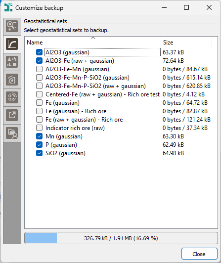
Geostatistical sets: The Geostatistical sets refer to data tables, selections and variables. Be careful when customizing your backup that removing a data table, a selection or a variable can impact the Geostatistical sets and can make them inconsistent. For more information, please refer to the Geostatistical Sets chapter.
- Chart files: Chart files can take up a lot of space. They are not images but contain data used for the display. Removing them from the backup can save a lot of disk space. For more information, please refer to the Chart files chapter.
-
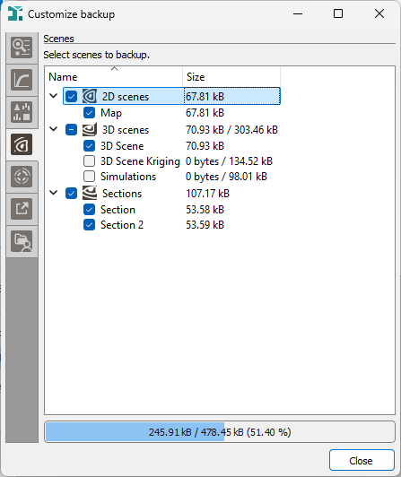
Scenes: 2D scenes, respectively 3D scenes and Sections, are grouped together to identify which ones are displayed in the Map, respectively in the 3D Viewer and the Section Viewer. For more information, please refer to the Scenes chapter.
- Neighborhoods: Neighborhoods can refer to variables when using Spread samples over categories or Capping options. In this case, be careful when customizing your backup that removing a data table or a variable can impact the Neighborhoods and can make them erroneous. For more information, please refer to the Neighborhoods chapter.
-
External files: The external maps which are not located into the project’s folder are listed here. Select the files that you want to copy into the public folder of the project to include them in the backup file. When restored, links on these external files in the scenes will be automatically updated to point on the public folder and retrieve the same display.
-
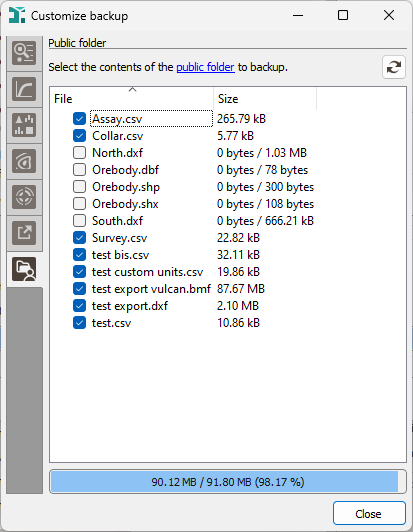
Public folder: All the files contained in the public folder of the project are listed here. They can be imported files, exported Geostatistical sets, background maps... A clickable link allows you to directly open the public folder.
Click Close to go back to the Backup Project interface and click Backup project to build your backup file.