
Projects & Databases
Studio Survey projects can contain links to both reference and database files. Data is either stored in a database, and is managed by your application's reporting tools, or outside the database (and is managed by other, non-survey-related tasks).
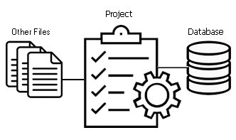
The Project Data control bar is used to manage all reference and database data associated with a surveying scenario. It displays the following top-level folders:
-
Survey Database: this data is stored within a managed environment with a specific and expected structure. This can be either a local or remote storage area, known as the Survey Database.
The Survey Database folder contains both inputs to, and outputs from, Studio Survey reporting functions, including EOM, ROM, Compliance and Blast Volume reports. Templates used to form reports, as well as the points, strings and surfaces used to determine the extent of excavation or dumping per time period are all stored here.
Your database is 'connected' to your Studio Survey project using Database Settings. Once connected, you can access managed survey / ground data. Data generated by Studio Survey is automatically stored in a location expected by the report publishing functions.Warning: Don't manually edit the contents of your survey database, This can break important links between Studio Survey and associated data files. Instead, configure your database structure using the Database Settings screen.
Project data files are supported by context-sensitive menus.
- Other Files
: "Other"
files are local files that sit in your local working environment,
and are used to support your survey data reporting, whilst not
explicitly used to calculate survey report results. This data
can be automatically reloaded when your project is closed and
reopened.
Typically, this data is reference data used to support the visualization or enhance your reports.
These files can be located anywhere accessible to the application (local, network, wide area network). A reference to each file is stored in your project file. File references persist until you remove them.
Common reference data can include: - A texture-mapped image demonstrating the context of a blast boundary within the locality.
- wireframes representing underground drives, declines and so on.
- Blast hole data, to compare with desurveyed blasthole collar positions.
- Surfaces representing known or interpolated contact surfaces surrounding the areas of interest.
- The strategic model from which pit phase data was borne, or an approved geological counterpart.
- A corporate standard evaluation legend file (.elg).
These files are supported by context-sensitive menus.
-
Loaded Data Objects: these files represent loaded data, also known as 'data objects'. This includes visual (3D) and non-visual (table) data. Every loaded data object appears here. Changes to objects does not impact the associated data file on disk unless you choose to save and commit changes to those files.
These objects are supported by context-sensitive menus.
- 3D (Visual) Objects:
3D files can be loaded into one or more 3D windows. They are then
represented by one or more overlays.
- Plots: Survey plots are listed in this part of the data bar. You can expand each item to reveal the data that comprises the plot. Selecting an item in this area automatically displays the Plots window.
Related Topics and Activities